

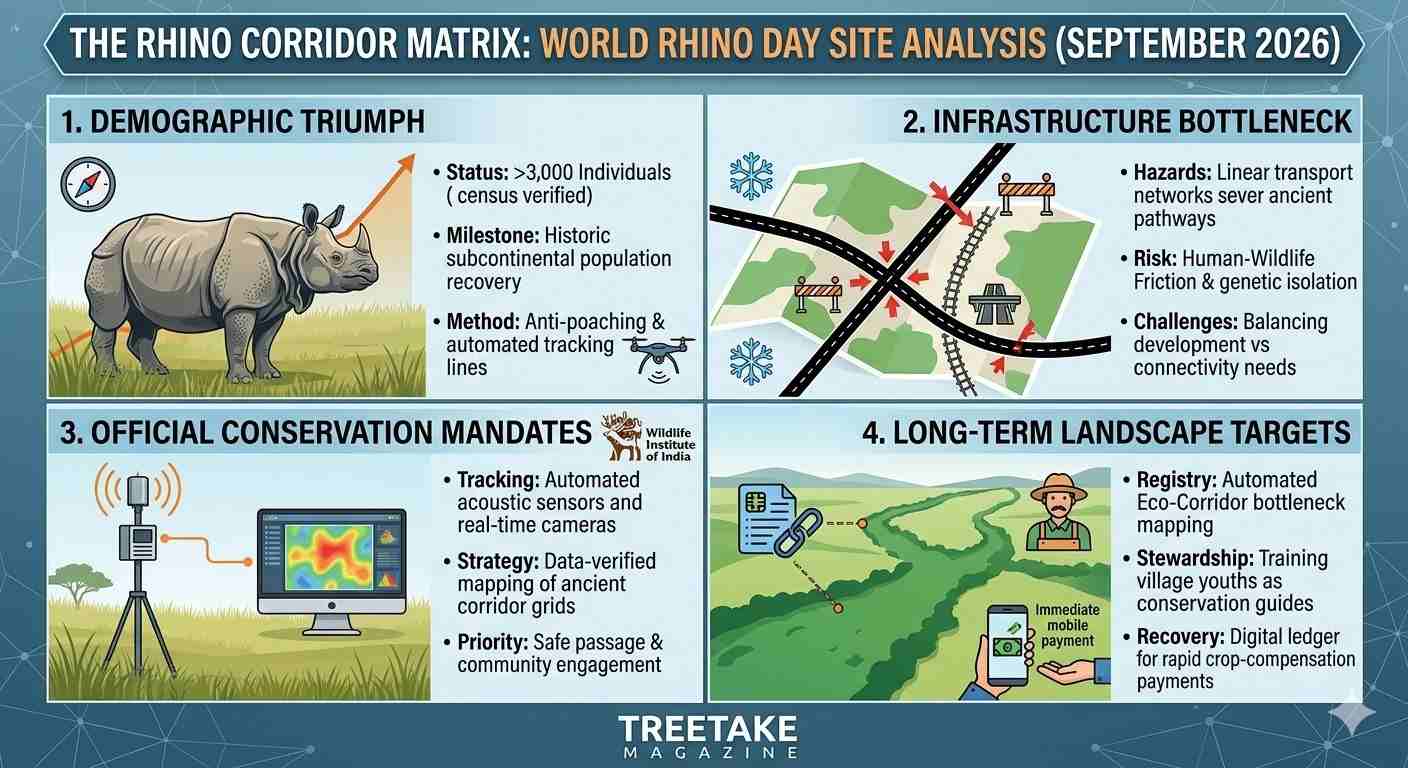
The architectural success of subcontinental megafauna protection faces a critical geographic constraint as global conservation bodies mark World Rhino Day. New consolidated population registers compiled by state forest departments and satellite tracking centres confirm that the greater one-horned rhinoceros (Rhinoceros unicornis) has achieved a historic population recovery, crossing three thousand individuals across its key subcontinental ranges. However, this demographic triumph is directly threatened by acute habitat fragmentation along protected border sectors, where linear infrastructure expansions are severing ancient seasonal migration paths. TreeTake presents a detailed operational report on this conservation milestone, examining the telemetry data tracking animal movements, the high stakes of linear transport projects, and the urgent implementation of wildlife corridors to protect the species from long-term genetic isolation.
Demographic Recovery and Spatial Constraints
The operational tracking grids monitoring the subcontinent's floodplain ecosystems registered an unprecedented conservation milestone today as multi-agency census logs confirmed a significant expansion in rhinoceros numbers. The demographic recovery, celebrated across premier protected zones, highlights the success of decades of aggressive anti-poaching operations, automated perimeter tracking, and strict habitat management. Moving past the historical crisis phases where numbers plummeted to near-extinction thresholds, the species has successfully re-colonised critical alluvial grassland swathes. However, this expanding demographic footprint has run directly into the unyielding constraints of heavily fractured sanctuary layouts.
Satellite tracking data indicates that while core sanctuary zones provide optimal foraging grounds during dry months, the natural expansion of matching family groups has forced younger bulls to disperse outward into heavily modified peripheral swathes. The field logs show that the high density of animals within restricted pockets—specifically within the core zones of Kaziranga National Park and Pabitora Wildlife Sanctuary—is driving animals to cross national highways and navigate human-dominated agricultural fringes to locate fresh grazing terrain. This spatial spread introduces severe operational challenges for local monitoring teams, who must execute round-the-clock physical tracking to prevent the animals from entering fatal transport corridors, encountering local anti-encroachment operations, or falling victim to opportunistic poaching rings operating along open river borders.
Official Monitoring Mandates and Corridors Infrastructure
The central environment ministry has issued clear directives to regional forest departments to enforce strict speed restrictions along major transit networks cutting through animal paths rather than attempting to artificially restrict natural wildlife movements. State conservation architects maintain that free-ranging dispersal is a non-negotiable metric for long-term population stability. "We are establishing a transparent, data-verified mapping framework of India's ancient wildlife corridors, and our teams are working to ensure that infrastructural blocks do not isolate these recovering populations," announced a senior wildlife biologist attached to the Wildlife Institute of India during an institutional coordination brief at the regional conservation centre. He clarified that field tracking teams are deploying automated acoustic sensors and real-time camera networks to secure immediate field updates. "Our primary focus is ensuring safe passage across these pathways by collaborating with local village communities, monitoring habitat choices, and executing rapid compensation clearances for any crop-raiding damage."
This adaptive stance has faced structural resistance from regional infrastructure developers and local planning bodies who bear the direct burden of executing high-speed transport links across the expanding economic corridors. Engineering groups argue that constructing elevated overpasses and extensive animal underpasses adds heavy fiscal burdens to project outlays and stalls key road completions. "Every major national highway expansion undergoes a multi-layered regulatory review, but locking vital capital infrastructure projects to unpredictable migratory movements introduces severe planning uncertainties," argued a senior project engineer representing the regional infrastructure development board. He stressed that maintaining an absolute freeze on construction along historical corridors ignores the pressing connectivity demands of regional populations. "We are balancing the massive, inevitable logistical demands of a fast-growing economic zone with responsible environmental planning, and our teams are working to install advanced speed-calming setups to satisfy the department's newest safety mandates."
The Silvicultural Critique and Landscape Carrying Capacity
The territorial expansion has revived an intense, high-stakes academic debate among international large herbivore specialists and subcontinental biologists regarding the ultimate landscape carrying capacity of the region's fragmented alluvial systems. Independent critics point out that existing protected sectors possess highly restricted core areas surrounded by dense agricultural zones, which is structurally insufficient to support a self-sustaining, genetically viable population without triggering continuous outward migration.
"The current corridor gridlock displayed across our rhino ranges exposes the fundamental ecological limitation of our isolated protected area layouts," argued Dr Alok Ranjan, a senior conservation biologist specialising in subcontinental megafauna dynamics. He emphasised that traditional isolated sanctuary models cannot be sustained when surrounded by rapid infrastructure networks. "When you successfully multiply a major herbivore population within a closed, compressed sanctuary, spatial saturation occurs rapidly. The animals are not moving because they are lost; they are migrating because the localised grass resources face severe seasonal flooding and the habitat is naturally full. Unless the government immediately transitions its strategy toward establishing large, multi-state landscape corridors that link these isolated parks to secure highlands, we will see a continuous rise in human-wildlife friction that could derail the entire conservation programme."
Strategic Pathways to Habitat Continuity
Securing the long-term future of the greater one-horned rhinoceros requires moving beyond defensive field tracking toward proactive landscape-level integration. The Ministry of Environment must establish a permanent, automated Eco-Corridor Registry, legally banning heavy commercial zoning and high-speed transport layouts within verified migration bottlenecks. Second, regional forest circles must deploy community-led stewardship models, recruiting and training local village youths as specialised conservation guides to manage public encounters and secure immediate field reporting of animal movements. Finally, the central government must establish an immutable, digital ledger for crop-compensation payments, utilising automated mobile banking to disburse market-rate financial restitution to farmers within forty-eight hours of a verified crop-raiding strike, thereby neutralizing local hostility and fostering an environment of tolerant coexistence across the expanding territorial frontiers.



Leave a comment