

TreeTake Network
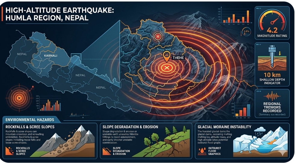
A sudden magnitude 4.2 earthquake struck the high-altitude Humla district within Nepal’s ecologically vulnerable Karnali Province on Friday, November 6, 2026. The seismic event occurred at a shallow depth of 10 kilometres, with its epicentre situated near the remote mountain settlement of Thehe, sending noticeable tremors across regional trekking routes and high-altitude alpine habitats. Initial aerial and ground assessments conducted by Himalayan disaster response units indicate that the shallow displacement triggered minor rockfalls across steep terrain boundaries, though no human casualties have been reported from the sparsely populated district. The high-altitude tremors have heightened fears regarding structural instabilities in glacial moraines and high-angle scree slopes across the northwest mountainous border.
Local authorities have immediately initiated safety protocols across the mountainous region to safeguard remote farming hamlets. Lok Bahadur Thapa, Regional Coordinator for the Karnali Disaster Management Authority, stated: "Our primary endeavour is to establish steady communications with the isolated high-altitude settlements near the epicentre, as the steep geological formations remain highly susceptible to secondary rockbursts." Highlighting the broader environmental implications, Professor Surya Narayan Shrestha, Executive Director of the National Society for Earth Technology, observed: "Shallow seismic shifts in these specific alpine corridors alter the micro-topography of fragile mountain slopes, which can dramatically accelerate soil degradation and alter natural spring water channels essential for local biodiversity."
Geologists are closely monitoring the area for potential cascades affecting glacial lakes downstream. Dr Tara Nidhi Bhattarai, Professor of Geology at Tribhuvan University, cautioned: "Even moderate tremors at these high altitudes can cause critical structural fractures in frozen debris dams, which increases the long-term risk of glacial lake outburst floods during subsequent warming periods." Furthermore, Professor Roger Bilham, Senior Research Scientist at the Cooperative Institute for Research in Environmental Sciences, emphasised: "The seismic energy released in the northwest Himalayan arc highlights the continuous tectonic strain accumulation along the active fault lines, requiring highly specialised sub-surface monitoring programmes to protect both natural ecosystems and human communities."
Editor's Note
The earthquake in Humla underscores the critical necessity of integrating geological vulnerability assessments into high-altitude ecological conservation initiatives. Future infrastructure planning across the Himalayan belt must strictly incorporate earthquake-resistant, nature-based stabilisation frameworks to mitigate the growing risk of landslide-induced habitat loss.



Leave a comment