

TreeTake Network
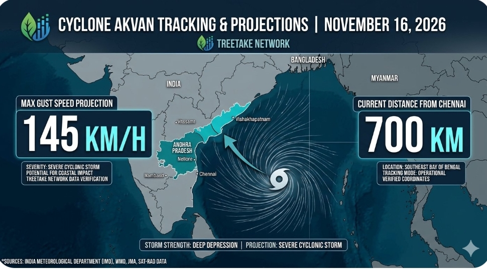
Meteorological systems over the Bay of Bengal have intensified significantly as a deep depression over the southeast and adjoining southwest oceanic sectors began a steady north-northwestward advance on November 16, 2026. The atmospheric disturbance, which has triggered emergency pre-cyclone watches across eastern coastal jurisdictions, is forecast to intensify rapidly into a cyclonic storm by the evening. Upon achieving cyclonic classification, the system will be officially named Cyclone Akvan, according to the tropical cyclone nomenclature protocol maintained by the World Meteorological Organisation. Operational tracking models indicate the system will then intensify into a severe cyclonic storm, posing a direct structural and environmental threat to the coastal expanses of Andhra Pradesh and adjoining south Odisha regions.
Atmospheric coordinates and projected landfall trajectories
Positioned roughly 630 kilometres east-northeast of Trincomalee and 700 kilometres east-southeast of Chennai, the deep depression tracked at a forward speed of six kilometres per hour, drawing energy from warm sea surfaces. Forecasters expect the system to cross the Andhra Pradesh and Yanam coasts near Nellore and Tuni as a very severe cyclonic storm by November 20, 2026.
Dr Mrutyunjay Mohapatra, Director General of the India Meteorological Department, noted that sustained wind velocities could reach 120 kilometres per hour with gusts up to 145 kilometres per hour during landfall. State administrations in Andhra Pradesh, Odisha, and West Bengal have activated readiness plans, warning of heavy downpours and high wave amplitudes. Special Relief Commissioner Dr Pradeep Kumar Jena confirmed that National Disaster Response Force units have been deployed across ten vulnerable sectors to facilitate zero-casualty evacuations.
This system marks the third major tropical disturbance in the Bay of Bengal within 20 days. Climate scientist Prof. Raghu Murtugudde attributed the high frequency to sustained marine heatwave departures from historical averages, warning that repeated storms heighten flash-flooding risks and demand long-term bio-shields like mangrove conservation.
Editor's Note
The rapid development of Cyclone Akvan underscores the need for climate-resilient engineering, combining predictive evacuation models with coastal wetland restoration to mitigate severe storm surges.



Leave a comment