

TreeTake Network
An international team of glaciologists, oceanographers, and climate modellers led by Australian researchers has delivered high-resolution simulations of the Antarctic ice sheet to help determine global sea-level rise projections for the forthcoming Seventh Assessment Report (AR7) of the Intergovernmental Panel on Climate Change (IPCC).
Coordinated by the Australian Antarctic Program Partnership at the University of Tasmania's Institute for Marine and Antarctic Studies, the project represents a major scientific contribution to the Ice Sheet Model Intercomparison Project for Coupled Model Intercomparison Project Phase 7 (ISMIP7), the global benchmark initiative standardising ice-sheet forecasts through to 2300.
High-Resolution Modelling of Ocean-Driven Ice Melt
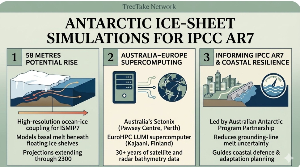
The Antarctic ice sheet holds enough frozen freshwater to raise global mean sea levels by roughly 58 metres if melted entirely, making its stability the single greatest source of uncertainty in multi-century coastal risk assessments. Unlike previous assessments that relied largely on standalone ice models, the new simulations couple ocean circulation dynamics with basal melting beneath floating ice shelves, where warm circumpolar deep water erodes glaciers from below.
Dr Chen Zhao, ice-sheet modeller at the Australian Antarctic Program Partnership and lead coordinator of the modelling effort, explained the scientific advance: "Warming Southern Ocean waters are melting floating ice shelves from underneath, weakening their ability to hold back inland glaciers and accelerating ice flow into the sea."
Dr Zhao emphasised that capturing fine-scale interactions at the grounding line—the critical zone where continental ice lifts off the bedrock and begins to float—is vital for reducing uncertainty in global coastal planning. "By combining high-resolution ocean and ice-sheet physics across multiple international models, we can give policymakers far clearer projections of how rapidly Antarctica could contribute to rising seas over the coming decades and centuries," Dr Zhao added.
Supercomputing Power Across Australia and Europe
Generating the multi-century ensembles required millions of core-hours on two of the world's most powerful supercomputing facilities: Australia's Setonix system at the Pawsey Supercomputing Research Centre in Perth, and the EuroHPC LUMI supercomputer hosted in Kajaani, Finland.
Dr Rupert Gladstone, glaciologist and senior researcher at the University of Lapland's Arctic Centre who co-led key numerical model integrations, highlighted the scale of international collaboration behind the dataset. "No single institution or supercomputer can tackle the complexity of Antarctic ice-ocean interactions alone," Dr Gladstone said. "Pooling computational capacity across Australia and Europe allowed us to run scenarios at resolutions fine enough to resolve narrow ice-shelf cavities that previously slipped through coarse global grids."
The modelling suite incorporates observational constraints gathered by the Australian Antarctic Division, including airborne radar bathymetry, autonomous underwater vehicle measurements beneath East Antarctic ice shelves, and satellite altimetry records spanning more than three decades.
Informing Coastal Adaptation and IPCC AR7
The completed datasets have now been deposited into the international ISMIP7 archive, where climate scientists worldwide will analyse model spread across low-, intermediate-, and high-emissions pathways ahead of the IPCC AR7 synthesis cycle.
Professor Matt King, Director of the Australian Centre for Excellence in Antarctic Science at the University of Tasmania, underscored the practical urgency of the findings for coastal nations and low-lying island states. "Every centimetre of sea-level rise translates into higher storm surges, accelerated coastal erosion, and saltwater intrusion into freshwater aquifers," Professor King noted. "Delivering rigorous, transparent Antarctic projections ensures governments and coastal engineers can design infrastructure for the climate realities ahead rather than relying on outdated assumptions."
Editor's Note
Reducing scientific uncertainty around Antarctic basal melting is indispensable for global coastal resilience, particularly across densely populated deltas and island nations in the Indo-Pacific. While advanced supercomputing simulations sharpen our understanding of physical tipping points in East and West Antarctica, translating these projections into actionable coastal adaptation standards and rapid global emissions reductions remains the decisive challenge before the IPCC Seventh Assessment Report is finalised.



Leave a comment