

Thinking Point
Sagari Gupta, Policy Research Consultant, explores how building rules, environmental clearance thresholds and a missing indicator let Indian cities lose living soil without any agency recording the loss.
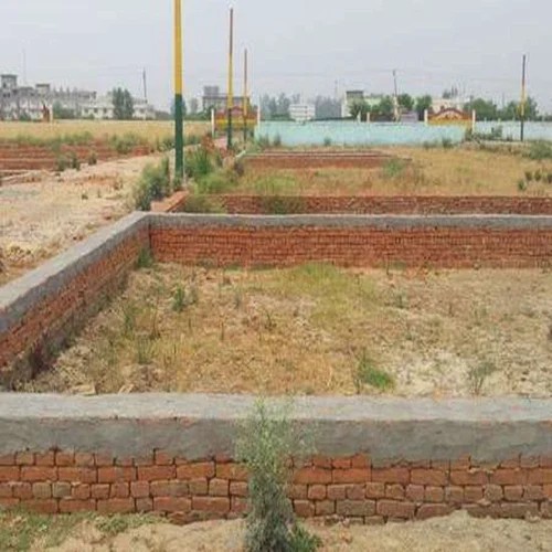
The Ministry of Environment, Forest and Climate Change require prior environmental clearance only for building and construction projects with a built-up area above 20,000 square metres, under Entry 8(a) of the Environmental Impact Assessment Notification of 2006. A housing colony built as 300 independent plots, or a row of commercial units developed one after another, stays below this threshold at every stage and proceeds without environmental scrutiny of any kind. On August 5, 2025, a Supreme Court bench led by Chief Justice B. R. Gavai ruled in Vanashakti v Union of India that construction above 20,000 square metres affected the environment regardless of its declared purpose, striking down a January 29, 2025 notification that had let industrial sheds, schools, colleges and hostels skip clearance up to a built-up area of 150,000 square metres. The judgment restored the size threshold. It left the deeper design of that threshold untouched: the rule is triggered by a single project's size, not by how many separate projects accumulate in one place.
This is where India's environmental data stops. The Forest Survey of India has published the India State of Forest Report on a fixed two-year cycle since 1987, using satellite imagery at 23.5 metre resolution to track forest and tree cover across every district, with the most recent edition, ISFR 2023, released in December 2024. The Central Ground Water Board, with State and Union Territory agencies, assesses groundwater conditions every year across 6,762 blocks, talukas and mandals nationwide. It released its most recent national assessment for 2025 on December 30, 2025. The Central Pollution Control Board runs 966 air quality monitoring stations across 419 cities and towns, the figure listed on its network as of November 2024. Each of these systems has an institutional home, a fixed schedule and a published methodology. No central or state agency runs an equivalent system for the exposed, absorbent soil inside Indian cities, or for how fast that soil is being sealed under concrete, pavers and basements.
The gap is not an oversight. It is structural, according to Debodipta Nandan, a research analyst in public policy governance. “Permeable soil has no statute, no reporting authority and no consequence attached to its loss”, Nandan said. Air and water each received a dedicated statute and a standing institution, under the Water Act of 1974 and the Air Act of 1981. Forests are tracked biennially by the Forest Survey of India, and groundwater is assessed annually by the Central Ground Water Board. Soil receives no equivalent instrument. The Environment (Protection) Act, 1986 defined environment broadly enough to include land, Nandan noted, but imposed no monitoring duty on anybody for it. Where soil is measured at all, through the Soil Health Card scheme and the ICAR soil survey system, it is measured as an agricultural input, assessed for fertility ahead of cultivation. Urban soil has no yield, so it exits the register at the moment the land is converted into a plot.
Rules that measure area, not what covers the ground
The Town and Country Planning Organisation's Model Building Bye-Laws, 2016 set the coverage, floor area ratio, setback and parking norms that states and urban local bodies use to sanction construction. These rules regulate how much of a plot a building occupies and how far it stands back from the road and its neighbours. They set almost no limit on what covers the ground within those setbacks. A builder who leaves the mandated open space technically complies with the bye-law irrespective of the fact whether that space is planted, gravelled or paved solid with concrete.
“There is a clear gap between project approval and post-construction implementation,” said Shrotik Bose, senior research associate at the Centre for Science and Environment. “With multiple authorities involved and overlapping responsibilities, there is often little monitoring of whether approved plans are actually implemented and functioning as intended.” Municipal building approval checked a sanctioned plan against coverage and setback numbers, Bose said, but rarely returned after construction to see what was actually built. The effects, in Bose's assessment, are already visible in almost every major Indian city: as permeable land is replaced by concrete and other impervious surfaces, less rainwater infiltrates into the ground and more becomes surface runoff, a shift that reduces groundwater recharge while adding pressure on urban drainage systems and raising the frequency of urban flooding.
A rule that checks the drawing, not the water
The Model Building Bye-Laws, 2016 require plots of 100 square metres and above to include a rainwater harvesting proposal at plan-sanction stage, a provision adopted by 33 states and union territories. “The mandate is written as a design condition rather than a performance condition, and the penalty is priced below the cost of compliance,” Nandan said. A drawing showing a recharge pit satisfies the sanction process. Nothing further down the chain checks whether water actually enters the pit, or whether it survives the plot changing hands or a floor being added.
Nandan argues both problems are correctable without new inspection machinery: shift compliance from the plan-sanction stage to the occupancy certificate, withheld until a functional test is passed; delegate verification to licensed third-party certifiers, the model already used for structural design proof-checking; make penalties escalate with duration rather than repeat as a flat fine; and attach revalidation to a cycle that already recurs, such as property tax assessment or water connection renewal, checked through self-declaration with random audit rather than universal inspection. None of these requires a new approval layer or additional municipal staff.
Several states moved on rainwater harvesting well before the Model Building Bye-laws existed. Tamil Nadu made it mandatory for all buildings, public and private, through a Municipal Laws Ordinance dated July 19, 2003, withholding water and sewer connections until compliance was shown. Rajasthan made it mandatory for public establishments and any urban plot above 500 square metres, with the Public Health Engineering Department empowered to withhold connections without proof of an operational structure. Karnataka extended the mandate to all buildings under the Bangalore Water Supply and Sewerage Board's jurisdiction, irrespective of plot size, through an amendment to Section 72A of the Board's 1964 Act. Each is a binding legal requirement, not a guideline, and none of the three states, nor the national government, publishes a periodic count of how many mandated structures still function or how much sanctioned open ground remains actually open.
What the ground was doing before the paving
The Central Ground Water Board's Dynamic Ground Water Resource Assessment for 2025, released jointly with State and Union Territory agencies in December 2025, puts national annual groundwater recharge at 448.52 billion cubic metres, against extractable resources of 407.75 billion cubic metres and annual extraction of 247.22 billion cubic metres, a national stage of extraction of 60.63 per cent. Groundwater supplies close to half of urban drinking water in India and the Board's own technical guidance names the paving of open ground in cities as one of the direct reasons rainwater infiltration into the subsoil has declined over time.
The 2025 assessment shows the national share of over-exploited groundwater units falling, from 17.24 per cent in 2017 to 10.80 per cent, or 730 of the country's 6,762 assessment units, though a further 14.18 per cent are classified semi-critical or critical, meaning close to a quarter of all units nationally show some stress even as the headline number improves. Read at city level, that improvement means less than it appears to. CGWB assessment units are drawn at block, taluka and mandal scale and a single unit can span a paved urban core and a peri-urban fringe where farmland and ponds still recharge freely. The unit's average reading can show as safe while its urban core runs dry through the year. The national recovery, which the Board attributes substantially to a stronger 2025 monsoon and to rural recharge, does not tell a city planner what is happening under a specific ward.
Sarang Kulkarni of the Alternative Development Initiative (ADI) argued the mismatch was fixable, but not simply by shrinking the assessment unit to ward size. “Groundwater recharge assessment at the ward level is feasible,” Kulkarni said. “However, the assessment should not begin with ward boundaries alone. Wards are administrative units. Groundwater is controlled by aquifers and local hydrological systems which may extend across several wards.” The correct starting point, he said, was to delineate aquifers and watersheds across a city using geological, topographic, drainage and land use data mapped in GIS, then overlay ward boundaries on that scientific map so findings could still be reported ward-wise even though aquifers remained the actual unit of assessment. This is not hypothetical: Pune has already mapped its aquifers and watersheds this way and inventoried wells for pre- and post-monsoon monitoring, work Kulkarni documented with Rajguru and Korde in a 2023 study for Pune's Advanced Centre for Water Resources Development and Management. Similar participatory groundwater work has been carried out in Bengaluru. What is missing nationally, he said, was not proof of feasibility but institutionalisation: no city had turned these pilots into a standing, standard assessment system.
On whether the improving national groundwater picture could be masking worsening conditions inside dense urban cores, Kulkarni was direct: it could, and often did. “When these contrasting conditions are assessed together, the relatively favourable situation in the surrounding areas can moderate the overall category,” he said. “This can happen even when stress is increasing within the city.” He pointed to a second driver that assessment units miss entirely: a city's groundwater footprint routinely extends beyond its administrative boundary. Tier I and Tier II cities with inadequate municipal supply lean on tanker water drawn from wells and borewells in peri-urban areas and nearby villages. “The demand is generated in the city,” Kulkarni said. “However, part of the extraction and its impact occur outside the urban core,” showing up as falling water levels in source areas a city's own assessment never captures, extraction that is “often informal and unmetered” and therefore hard to estimate at all.
Kulkarni supported building a periodic indicator of urban permeable surface loss, but cautioned against reading it alone. “Permeable surface data should not be considered alone,” he said. “It should be studied with aquifer conditions and groundwater level trends. Rainfall and groundwater extraction should also be included.” Rainfall determines how much water is available for recharge, permeable surface determines how much of it can enter the ground and extraction determines whether the resulting balance holds. Read together with aquifer mapping and a denser observation well network, of the kind Pune has already piloted, permeability data would let cities target land use and building decisions where they matter, rather than relying on a district-scale average that can mask a city drying at its centre while its edges still recharge.
A clearance process built around one plot, not one catchment
Environmental clearance in India is built around single projects crossing a size threshold. It has no mechanism for the cumulative footprint of many smaller projects developed in the same locality over time. “This might be the largest structural loophole in urban environmental regulation,” Nandan said, “and closing it does not require entirely new legislation.” Entry 8(a) of the 2006 notification is triggered by the size of one project, so a hundred developments of 19,000 square metres each, built one after another in the same neighbourhood, attract no clearance obligation at all. Judicial attention, including the Vanashakti judgment, has focused on defending the threshold itself rather than on the aggregation problem that sits beneath it.
The gap runs deeper than the notification's wording, in Nandan's account. The body that appraises environmental impact and the body that grants building permission are different institutions: State Environment Impact Assessment Authorities (SEIAAs) handle appraisal, urban local bodies issue building permits and neither maintains a running, catchment-level record of how much land has already been built over. “Nobody holds the running total,” Nandan said.
Nandan points to two existing instruments as evidence that fixing this does not require Parliament to legislate. The Central Pollution Control Board's Comprehensive Environmental Pollution Index already scores industrial clusters across air, water and land and a score of 70 or above has historically triggered a moratorium on new projects in that cluster. The Central Ground Water Board already categorises its 6,762 assessment units as safe, semi-critical, critical or over-exploited. Both are executive instruments under the Environment (Protection) Act, 1986, requiring no amendment to reach urban land. Applying the same logic, Nandan's proposal would designate the catchment rather than the individual plot as the unit of assessment, require SEIAAs and urban local bodies to jointly maintain a running permeability and recharge balance for each catchment and make building permission in critical or over-exploited units conditional on no net loss of infiltration capacity, met on site or through a verified offset in the same catchment. Individual small projects would stay outside project-level clearance, which Nandan calls proportionate. They would simply become visible once counted together.
The argument against counting it
Officials and developers raise a fair objection to any new permeability requirement. India faces a well-documented shortage of urban housing and construction costs already run high. Adding a permeability mandate, the argument goes, slows housing delivery when the country needs more of it, not less.
The objection assumes a new burden where none exists. Rainwater harvesting has been binding law across large parts of urban India for more than two decades, through Tamil Nadu's 2003 ordinance, Rajasthan's plot-size mandate, Karnataka's amended water board law and the Model Building Bye-Laws' national threshold. What is missing, in both Bose's and Nandan's independent assessments, is verification that these rules hold after a building is occupied and a mechanism that adds up what many small projects do to one catchment over time. Closing the gap does not require a new law layered on the ones that already exist. It requires enforcing the rules already in the books and building one indicator that does not yet exist.
What would need to change
Asked what single reform would do the most for urban hydrology, Nandan named a binding permeability standard inside the statutory master plan, enforced through a city-scale cumulative ledger, calling the two halves complementary. The master plan route binds every plot, including those below every clearance threshold. Urban planning already sits with local bodies under the Twelfth Schedule and with development authorities under state town planning law, so the change is state-level and needs no central statute. The Urban and Regional Development Plans Formulation and Implementation Guidelines, the template most states already use for master plans, could carry a minimum permeable area ratio per plot, differentiated by zone, with basement footprints counted as sealed rather than exempted.
A per-plot standard alone was defeated by subdivision and by basements built to the plot edge beneath a token strip of lawn, Nandan said. A ward or catchment-level ceiling on total sealed area closed that, and could be built now from National Remote Sensing Centre and Bhuvan satellite imagery, comparable in resolution to the European Union's, without new field data collection. NRSC already generates national land use data every five years, with a coarser annual series, but classifies built-up area as a land use category rather than a permeability measure. The imagery exists. The indicator does not.
Nandan places the priority on permeability because its loss does not reverse. Air quality can recover within a season of effective action. Soil sealed beneath a building does not return. Bengaluru's paved surface grew by 1,055 per cent between 1973 and 2023, alongside an 88 per cent decline in vegetation cover over the same period, a scale of change Nandan cited as a warning of what continued unchecked wherever no ceiling existed.
Three changes would close the gap
1- Cities need a soil and permeable-surface indicator, published on the schedule used for forest cover or groundwater, built from land use and land cover imagery the National Remote Sensing Centre already produces, converted from a land use classification into a standing permeability measure.
2- Municipal permitting needs to move its rainwater harvesting check from the plan-sanction stage to the occupancy certificate, verified through licensed third-party certifiers and revalidated on a cycle already tied to property tax or water connection renewal.
3- Environmental governance needs a catchment-level permeability and recharge ledger, maintained jointly by State Environment Impact Assessment Authorities and urban local bodies, on the model the Central Pollution Control Board already uses for the Comprehensive Environmental Pollution Index and the Central Ground Water Board already uses for its assessment-unit categories.
None of these three changes appears in any current draft notification or state building code. Until one does, India will keep adding paved surface to its cities at a pace no agency records, treating a measurable environmental change as though it leaves no trace.


.jpg?resize=120%2C90&ssl=1)



Leave a comment