A ‘good place’ threatened
Arunima Sen Gupta
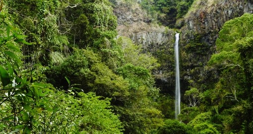
The mountainous forests of northern Madagascar are biodiverse beyond measure, containing plant and animal species found nowhere else on the planet. Tsaratanana, which means “good place” in Malagasy, has a certain mystique among scientists. “It’s a magical forest … the most mysterious place in the entirety of Madagascar,” Maria Vorontsova, a botanist at Royal Botanic Gardens, Kew, who has worked in the reserve, informs. Other forests in Madagascar have been lost in recent centuries and decades, but these have stood the test of time and remained relatively unscathed. They are difficult to access, and some have been officially protected since the 1920s. And yet their protected status is no longer enough: satellite data show they are now being cut down at an increasing rate. Levels of deforestation have speeded up since September, according to satellite data from the University of Maryland (UMD) visualized on Global Forest Watch. The dry months of September and October are normally peak season for slash-and-burn, and sources say the clearing is especially severe due to economic pressures caused by the COVID-19 pandemic.
Experts say the forests are being burned and cleared primarily to make space for fields of marijuana, vanilla, and rice. The scale of the biodiversity loss is immeasurable, conservationists add. Many of the forest areas are so remote that their flora and fauna have not yet been surveyed. “This is a loss for everyone,” Brian Fisher, an entomologist at the California Academy of Sciences who has worked in the region, says after looking at satellite images that show the deforestation. “It hurts my heart to see these patches. It hurts because I know that the value of the forest as a forest is so much more.”
It’s now unclear how long the reserve will remain in good health. Tsatananana’s river valleys, where species richness is especially high, are being stripped of their forests, more so than in past decades, when they did face some threats. Meanwhile, at higher altitudes, once-continuous forest is being threatened for the first time as clearing advances upward; which researchers say marks the threshold for habitat that is particularly important for the region’s endemic, endangered wildlife. Satellite imagery shows recent deforestation encroaching above 1,600 meters in elevation, which researchers say provides the most important habitat for the region’s endemic species.
The change did not come overnight. Deforestation levels in Tsaratanana inched up in recent decades, then exploded in the past few years. Between 1996 and 2006, Tsaratanana lost only about 0.1 % of its forest cover to deforestation per year; things got worse from 2006 to 2016, when the level of deforestation increased to about 0.5 % per year, according to a three-volume compendium of Madagascar’s protected areas published by the University of Chicago Press in 2018. Since 2016, the rate has been 1.3% or higher every year, according to Madagascar National Parks (MNP), a semi-public agency that manages the reserve. Government data for 2020 is not yet available, but preliminary satellite data from UMD visualized on Global Forest Watch indicate the deforestation rate in 2020 may be higher than in years past.
The double whammy of deforestation and climate change could have a severe impact on wildlife populations, scientists warn. Tsaratanana’s elevational range makes the area suitable for a diverse set of plants and animals, including, for example, four genera of endemic bamboo (Hickelia, Oldeania, Sokinochloa and Nastus) and 15 species of tenrec (family Tenrecidae), a shrew-like animal. The reserve also provides crucial habitat for several threatened species found nowhere else in the world, including at least four endangered frog species: Rhombophryne guentherpetersi, Rhombophryne ornata, Rhombophryne tany and Cophyla alticola.
Many species will likely have to shift upslope as the area warms. Indeed, the warming is already pronounced — the protected area’s average temperature increased by 2.4° Celsius (4.3° Fahrenheit) between 1985 and 2014, according to the compendium — and some species have already shifted. If their habitats become fragmented by deforestation, they may have nowhere to go to escape the heat. The primary cause of deforestation in Tsaratanana is marijuana cultivation, according to MNP. The area is reportedly attractive to marijuana growers and smugglers because of its remoteness. Marijuana cultivation is illegal in Madagascar, regardless of protected area status, and Tsaratanana is one of only two major production areas.
Some of the marijuana product is exported via Nosy Be, a coastal city in the northwest, to nearby Indian Ocean islands. It fetches high prices in the island of Mauritius: an average of about $67 per gram, according to a forthcoming report from the Global Initiative Against Transnational Organized Crime. Marijuana is also consumed in Madagascar. The price there is low — about $0.03 per gram — but it’s still considered a profitable domestic business. To stop the clearing and burning, MNP is partnering with law enforcement, forming what it calls “mixed brigades” that descend into the depths of the forest. According to MNP, the brigades have conducted five missions this year, during which they arrested 13 people, destroyed dozens of camps and shelters, and incinerated several tons of marijuana that had already been packaged in bags and cans; they also destroyed 35 hectares (86 acres) of marijuana fields. Tsaratanana is not the only protected area in the region facing deforestation pressures due to shifting agriculture. Tree cover loss data from the University of Maryland show surging deforestation in COMATSA, which borders Tsaratanana Reserve to the west and Marojejy National Park to the east.


Leave a comment